Gravel Trans Jura
Offline bikepacking navigation app with Swiss survey maps and QR checkpoints
- 6 weeks
- from kickoff to delivered app
The story
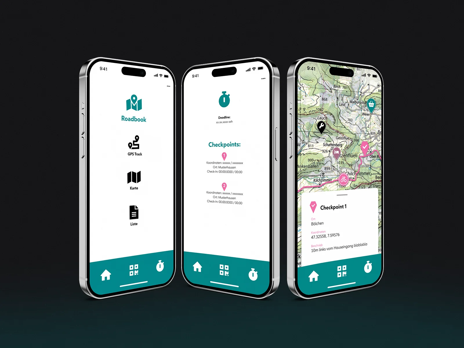
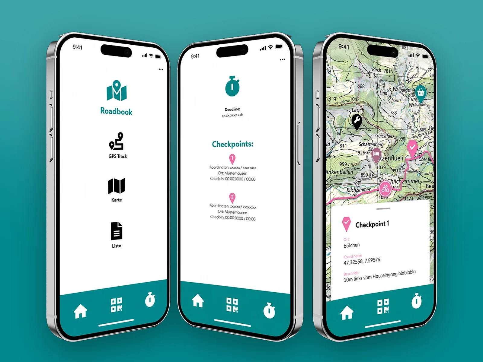
Gravel Trans Jura is a gravel cycling event in Switzerland. The organiser needed a navigation app for riders before the event, with precise tracking on Switzerland's official topographic maps, QR checkpoints along the route, and full offline use for stretches with no signal.
We won the project before we were hired. Other freelancers quoted the custom map integration without looking at it. We downloaded the map toolkit, built a quick prototype, and gave a structured quote based on what the integration actually takes, which also made the custom maps fit the client's budget.
The app was delivered 6 weeks after kickoff and is on Google Play.
“Very high level of commitment, always focused on achieving the project goal. Pleasant and professional collaboration. App meets the requirements.”
What was hard, and how we solved it
Problem
No signal out there
The route crosses mountain ranges where phone coverage simply disappears for hours at a time.
Everyone rides alone
Riders set their own pace, so there is no pack to follow and no marshal standing at every turn.
Checkpoints need proof
Organisers have to know who passed where, without staffing every point along 400 kilometres.
Solution
Full offline mode
The map and the whole route sit on the phone, working the same with no connection at all.
Swiss survey precision
A custom SwissTopo map SDK brings in national survey data, accurate on tracks generic maps never show.
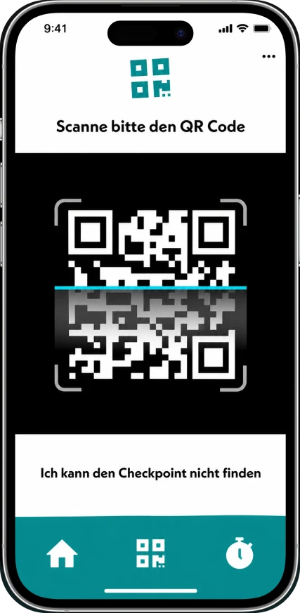
QR checkpoints
Riders scan a code at each checkpoint and it is logged straight away, with nobody needed on site.
Inside the app